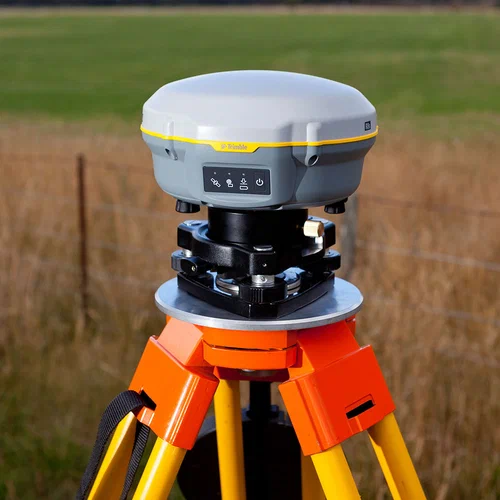
Satellite navigation has become a vital part of modern life, enabling everything from smartphone maps to aircraft navigation and autonomous vehicles. But how exactly does this technology function? In this article, we’ll explore understanding gnss: how satellite navigation works, breaking down the science, systems, and applications behind it.
What is GNSS?
GNSS stands for Global Navigation Satellite System. It is a general term for satellite navigation systems that provide geo-spatial positioning with global coverage. The most well-known GNSS systems include:
- GPS (Global Positioning System) – United States
- GLONASS – Russia
- Galileo – European Union
- BeiDou – China
Each of these systems consists of a constellation of satellites orbiting the Earth and ground control stations that manage and monitor them.
How GNSS Works
To understand GNSS, it helps to know the basics of how satellite navigation operates. The process involves the following key components:
1. Satellite Signals
GNSS satellites constantly transmit signals containing their current time and orbital position. These signals travel at the speed of light and are picked up by GNSS receivers on Earth.
2. Time and Distance Calculations
When a receiver picks up signals from at least four satellites, it uses the time delay between signal transmission and reception to calculate the distance to each satellite. This process is called trilateration.
3. Determining Location
With distances measured from multiple satellites, the GNSS receiver can determine its precise location (latitude, longitude, and altitude) anywhere on Earth.
Key Technologies Behind GNSS
Atomic Clocks
GNSS satellites carry highly accurate atomic clocks to maintain precise timing, which is crucial for accurate positioning.
Ground Control Stations
These stations monitor satellite health, orbit, and time synchronization, ensuring the system remains reliable.
Augmentation Systems
To improve accuracy and reliability, some regions use augmentation systems like WAAS (Wide Area Augmentation System) or EGNOS (European Geostationary Navigation Overlay Service).
Applications of GNSS
Understanding GNSS: how satellite navigation works helps highlight the vast number of real-world applications, including:
- Navigation and Mapping – In smartphones, cars, and aircraft.
- Precision Agriculture – Guiding farming equipment with high accuracy.
- Disaster Management – Locating people and coordinating emergency responses.
- Scientific Research – Tracking tectonic plate movements and atmospheric studies.
The Future of GNSS
The technology behind GNSS continues to evolve. Improvements in satellite hardware, ground control, and augmentation systems are increasing accuracy to within centimeters. Understanding GNSS: how satellite navigation works will become even more important as it integrates further with AI, IoT, and autonomous systems.
Conclusion
In summary, understanding GNSS: how satellite navigation works involves exploring a sophisticated interplay of satellites, signals, timing, and computing. From daily navigation to advanced scientific applications, GNSS is a cornerstone of modern technology—and its importance will only grow in the years ahead.


